Alysha Zazubec (GEL’ 23) and Elias Adamson-Endres Present at the Geological Society of America (GSA) 2023 Meeting.


Alysha Zazubec (GEL’ 23) and Elias Adamson-Endres Present at the Geological Society of America (GSA) 2023 Meeting.

Tess Eichner (WTR’24) Presents at the
2024 New York State Wetlands Forum
Annual Conference and Meeting. Tess also won the 2024 New York State Wetlands Forum (NYSWF) Student Research Award for her research titled “Bergen Swamp Hydrology and its Impact on Black Creek Water Chemistry.”

Orlensy Castillo Brito (Earth Science Education ’26) presented at the National Conference for McNair Scholars and Undergraduate Research.

ESC 195 Natural Disasters Honors
section presented a poster at the Annual Scholars Day (2024).

Andrew won the First place award in the Friends of Drake Library Research Contest (Advisors Dr. Kar and Dr. Woodard) for his senior research paper entitled: “Paleoclimate changes in the Northwest Pacific Ocean as inferred from Mid-Pliocene Biogenic Silica at ODP Site 1207.”

Orlensy won the John R. Halstead Family Leadership in Higher Education Award and Leadership Development Program Gold Leadership Certificate.

I had an internship with NASA during Summer 2023. The Student Airborne Research Program (SARP) provided me with exciting research experience and also introduced me to fieldwork! During the program we conducted flights across California gathering air quality data. I then had the opportunity to create our own individual research project from the airborne data I collected. With my prior experience from my senior research, I could hit the ground running with this project. I met incredible people and had an amazing summer doing what I love.
Before starting graduate school in the August 2024, I applied to the Mount Washington Observatory internship for January-May 2024. Given my passion for winter weather, I couldn’t resist this opportunity. Living at the summit of Mount Washington and working at the observatory fulfills all criteria for my dream job. The job is inter- disciplinary, we forecast, collect data, do fieldwork and educational outreach, and do research! The breathtaking view of the White Mountain Range from our office is another bonus. This internship has pushed me to be a well-rounded meteorologist. I’ve published forecasts, assisted with instrument support, shoveled several feet of snow, and am doing a research project on the climatology of snow-to-liquid ratios on Mount Washington.
The education I acquired during my time at SUNY Brockport is being used every day, and I feel both ready and enthusiastic. Without my supportive professors who believed in me even when I had doubts, I would not be in my current position. I am so grateful I went to SUNY Brockport, worked with the Earth Science department professors, and every decision that has gotten me to where I am today that has led me to my achievements.
Last summer I fortunately got the opportunity to attend the First Annual Radar Institute(FARM). This took place for a week at the
University of Illinois Urbana-Chamaign campus. During my time there, we learned about mobile radars and how they operated. We also learned about how they are used for severe weather tracking during the warm season in the US. We were also taught how dual doppler radars work and how it is used. Dual doppler radar is when either one or two mobile radars are used at the same time in order to get the vertical and horizontal planes of the atmosphere. This helps us better under- stand and see the structure of the storm along with seeing how fast the given storm is actually moving. Dual doppler radar can also help us depict what type of precipitation is happening, and if it happens to a different object such as birds or insects.

I first learned about this internship through my professor Casey Griffin. He helped pass along some of the information about it. Some classes that also helped me qualify for this internship were synoptic meteorology 1 and 2, and climatology. The class that was the most helpful was the forecasting lab, as we had to forecast and pick the best day to go out in the field and collect data. Thank you to everyone who helped me get this awesome internship.

I am currently employed by the Bureau of Land Management (BLM). I was employed by the Upper Snake Field Office (USFO) based in Idaho Falls, Idaho. I first started my job search back in December of 2022 on USAjobs.gov, as they post federal positions and internships year-round for a variety of federal positions. Federal jobs are fairly hard to get hired for, but they offer a lot more job security than the private field, specifically for us geology majors, in my opinion. There is a lot of bureaucracy to the work you do and paperwork to be done, but it’s all well worth it, in my opinion, as most of the time, you get to actually see the difference you make in the land you manage for the BLM. I was emailed that I had been approved for a position in February of 2023 after applying in December for the position as a “1399” or physical
science trainee at the GS-4 level. The GS scale is the payscale most federal agencies work off of for payment; pay scales are set at each GS level regardless of job. You can apply for GS-4 after 2 years of college, GS-3 after 1 year, and GS-5 you can apply for when you have your bachelor’s. You can also apply for GS-5 after 1 year of experience at GS-4 and so on and so forth with the higher GS scales. The system for interns in most Department of the Interiors agencies is that you get hired your sophomore junior summer as a GS-4 and then work the next summer as a GS-5. Then, out of college, you’re a GS-7 with your bachelor’s or a GS-9 with a master’s. The cool thing about federal positions is you do not need to get your master’s to reach GS-9 or GS-11. You simply have to work a year as the lower grader and meet performance standards.
My job as an intern was to catalog and inspect all of the mineral pits (~118) the BLM had in the Idaho Falls USFO district. Mineral pits are essentially just gravel or sand pits. They are the locations where the BLM has leased out federal land to a private entity or a town for usage in buildings, road construction, or public works. They charge the entity for both the material and the subsequent reclamation or cleanup and fixing of the said site back to wild form. I would take measurements of the pits with my Brunton compass and a measuring tape roll to get slope angles and lengths and then calculate the amount of material taken from the pit. This was done so we could check every so often to ensure the private entity that had been permitted to extract the material was telling the truth and not overstepping the limits set in the permit for removal. I would also draw up and sign permits with private entities for new pits or permit renewals, as most towns use BLM mineral seasonally as road construction material. The BLM geologists gave feedback on project plans when needed. When I wasn’t doing geology work, I would help out other members of the field office in their tasks. I participated in a resloping and replanting project on Henry’s Lake to help with bank erosion occur- ring and ended up planting 300 Coyote willows after they had used an excavator to plow up and slope the embankment. I also helped in fenceline management. Federal land is often used as grazing land by local farmers possessing grazing permits for their cattle. The land is fenced off with barbed wire to keep the cattle in these allotments from wandering outside of said allotments. The fence lines need to be updated yearly.
During the internship, I rarely stayed in the office more than 2 days a week; roughly 90% of my time was in the field. In the wintertime, fieldwork slows down, and permitting starts up, so expect more in-office time unless other projects call you away. Most of Idaho has been looked at thoroughly geologically, but sometimes you will locate things other people haven’t seen quite yet just from the remoteness of some of the areas you come to. It’s a great experience as a geologist to actually be in a location working where you can actually see it all around you no matter where you’re actually looking, and even though the job I do isn’t as geologically intense as others in our career field, it’s still quite fun for me.

In order to measure abundance, samples are dissolved in a procedure that lasts several hours. Then, a machine measures the concentration of what diatoms are composed of, silica. Some math work is required to calculate the actual abundance from the silica concentration measurements. This work is being done as part of my under- graduate thesis. Although I did not know much about oceanography at the beginning of this project, my previous coursework prepared me to do the research and learn. Even if I do not pursue a career in oceanography specifically, my laboratory experience will be useful, and I am glad that I have it.

My research journey started at Brockport. During my time in undergrad, I completed a senior research project alongside Dr. Casey Griffin analyzing characteristics of the May 31, 2013 El Reno tornado. This research provided my first insight into the process of creating and solving scientific questions. I gathered more experience in coding and had the opportunity to use radar data! We are continuing this research to completion of the lifespan of the tornado, continuing to analyze trends in circulation and vorticity as it expanded to become the largest tornado on record. This research project has been pivotal, it solidified my goal to continue my education in graduate school.
Three Geology students, Alysha Zazubec, Nicholas Mills, and Nicole McIntyre, participated in a 3-week long field camp in Western Montana. Alongside the fieldwork, the students visited the Yellowstone National park, and the Craters of the Moon National Monument with Geology faculty Dr. Daisuke Kobayashi.
Geology and Earth Sciences students also participated in class field trips and NYSGA field trips to local places. They collected fossils, measured and described rocks to figure out the geologic history of our region.
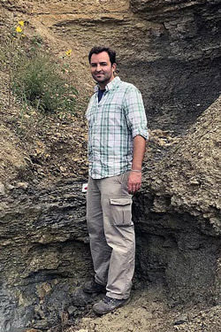
Dr. Jay Zambito
Associate Professor
Dept. of Geology, Beloit College
September 16, 2023 - Devonian climate trends have long been studied within the context of biological change. For example, the End-Devonian glaciation is traditionally thought to be related to a long-term carbon dioxide drawdown due to the evolution of forests during the Middle through Late Devonian. More recent paleoclimate reconstructions indicate that the Devonian climate story is more complex: long-term shifts are marked by repeated, short-duration, globally recognized extinctions and/or migrations as well as carbon-cycle perturbations coincident with marine anoxia. This presentation outlines efforts using stable carbon isotopes to reconstruct this climate volatility as recorded in the Northern Appalachian Basin strata of New York State.
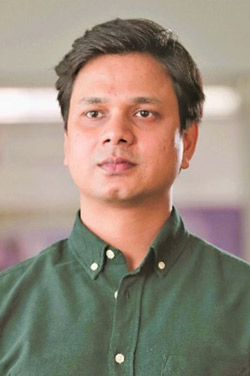
Dr. Vikram Vishal
Professor, Dept. of Earth Sciences
IIT Bombay (Mumbai, India)
November 7, 2023 - The rapid growth of the human population and the global economy has fueled a worldwide surge in energy consumption. An increase in energy production has directly resulted in a significant increase in anthropogenic CO 2 emissions – a major cause of global warming. With efforts being made for transition to cleaner fuels and improved efficiency of the energy-related processes, it may be important to keep a check on the total CO2 emissions during the transition to net-zero emissions. Incorporating carbon capture, utilization,nand storage (CCUS) into its national climate plan of the developed and emerging economies will accelerate abatement of CO2 emissions in the atmosphere.
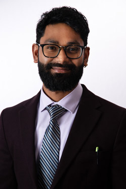
Dr. Kaushik Mitra
Assistant Professor, Dept. of Earth and Planetary Sciences
UT San Antonio
April 19, 2024 - Mars has captivated mankind’s attention for thousands of years due to its characteristic red color. But Why is Mars Red? Oxidized iron (Fe) and manganese (Mn) minerals on Mars are geochemical markers of past environmental conditions. Various processes that form these planetary materials on Mars have been previously proposed, including chemical oxidation using molecularoxygen (O2) and photo-oxidation by ultraviolet (UV) rays. This talk discusses the formation of Fe and Mn oxide minerals by oxyhalogens [perchlorate, chlorate, and bromate] under Mars relevant conditions using a combination of lab experiments.
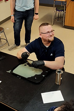
My journey as an educator was an endeavor that has truly shaped my life. After receiving my Associates from Genesee Community College, I transferred to SUNY Brockport in 2018 in the hunt for my Bachelors of Science with an education certification intent in Earth Science. I spent four total years at Brockport and could not place a value on the knowledge and experiences I gained.
Being an Earth Science major at SUNY Brockport gave me several opportunities to explore the processes that shape and change the natural world in the field. From local trips around Rochester to an overnight camping experience in the Catskills, my time at Brockport truly laid the groundwork for who I am as a person and the knowledge I have as an educator. The classes were rigorous but the support from the Earth Science instructional team made success easily attainable. My family and my now fiancée Ari pushed me to work hard and complete my goals, but without the support from Dr. Noll and Dr. Kar, those goals would have been much harder to reach.
I completed my student teaching placement in RCSD in the very building I currently teach at as a 7th grade/Earth science educator. Through recommendation by Dr. Noll, I will be graduating with a Masters in Geoscience with a concentration in Environmental Geoscience this summer after completing my research in the mountains of Western Washington. Because of SUNY Brockport, I can live my dream life everyday!
As an Environmental Geologist for Unicorn Management Consultants, LLC (UMC), I often reminisce about my eventful journey at SUNY Brockport. I entered the Geology program in the Spring of 2019, after transferring from Genesee Community College (GCC) with no idea of what I will specialize in. As time progressed, I enrolled in more Geology-oriented classes and my specialization came into better focus. After taking classes with Dr. Richards and Dr. Zollweg, involving the use of Geographic Information Systems (GIS), it felt like I had a lot of untapped potential in that field and I wanted to learn more. I did just that; with the help from Dr. Kobayashi, I chose a senior thesis that was GIS-intensive, which was to ultimately determine the origin of pop-up ridges in the Chaumont, Jefferson County, NY region. The research for my thesis involved multiple trips to the field for observations and mapping the pop-up ridges on ArcMap using LIDAR imagery.
My Senior Thesis presentation was the beginning of my professional career. Later the same night of my presentation, I met with Dr. Richards and others to socialize and celebrate graduation. I was then asked if I wanted to work in Connecticut. Although moving to Connecticut involved me moving away from my family and my girlfriend of five years at the time, I knew it was worth it in the long run. I am currently living with my girlfriend (now of seven years) in Connecticut, and we are happier than ever. I am currently the head of GIS and a Project Manager for a few contaminated sites in Vermont as a UMC employee. A major benefit of the Earth Science program at SUNY Brockport is the abundance of opportunity to go on trips to the field. Some of the many trips included traveling to the Catskill Mountains, Letchworth State Park, and Craters of the Moon National Monument and Preserve in Idaho. Field trips are pivotal in any Earth Science discipline and it becomes evident outside of college. To this day, I thank Dr. Richards, Dr. Kobayashi, and the entire Earth Sciences department at SUNY Brockport for guiding me from start to finish. The Earth Science Department does an excellent job at preparing its students for the professional work environment; whether it is in the field, the office, or in a classroom teaching the younger generation.